The Anderson Municipal Airport (AID) is a General Aviation airport owned and operated by the City of Anderson, conveniently situated near I-69 in Madison County, just northeast of Indianapolis.
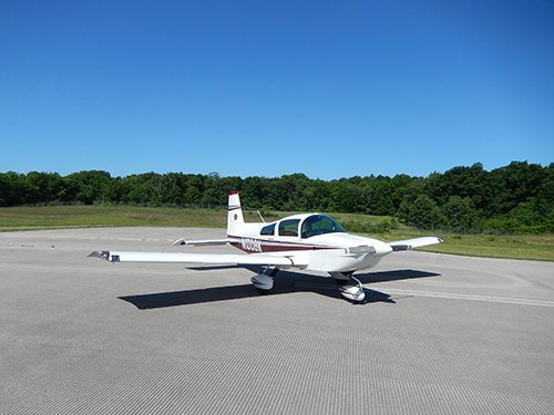
Whether you are learning how to fly, have an aircraft based on the airport, or are just planning a quick fuel stop, everyone is always welcome at the Anderson Municipal Airport.
The Anderson Municipal Airport provides an air traffic control tower, state-of-the-art facilities, passenger and cargo terminal, and two large runways. The airport offers one of the lowest air fuel and hangar rental costs in the region and owns and operates the adjacent Aero Industrial Park.
FAA Identifier: AID
Lat/Long:
40-06-31.0000N 085-36-46.8000W
40-06.516667N 085-36.780000W
40.1086111,-85.6130000
(estimated)
Elevation: 919.1 ft. / 280.1 m (surveyed)
Variation: 03W (1985)
From city: 3 miles E of ANDERSON, IN
Time zone: UTC -4 (UTC -5 during Standard Time)
Zip code: 46017
282 Airport Road
Anderson, IN 46017
Phone: 765-648-6293
MON-SAT: 0830-1630
SUN: CLOSED
Dimensions: 5400 x 100 ft. / 1646 x 30 m
Surface: concrete/grooved, in excellent condition
Weight bearing capacity:
Single wheel: 45.0
Double wheel: 55.0
Double tandem: 85.0
Runway edge lights: medium intensity
Latitude: 40-06.716773N
Longitude: 085-37.376338W
Elevation: 880.1 ft.
Traffic pattern: left
Runway heading: 118 magnetic, 115 true
Displaced threshold: no
Markings: precision, in good condition
Visual slope indicator: 4-light PAPI on left (3.00 degrees glide path)
Approach lights:
Runway end identifier lights: yes
Touchdown point: yes, no lights
Instrument approach:
Obstructions: 117 ft. trees, 1831 ft. from runway, 519 ft. right of centerline, 13:1 slope to clear
Dimensions: 5400 x 100 ft. / 1646 x 30 m
Surface: concrete/grooved, in excellent condition
Weight bearing capacity:
Single wheel: 45.0
Double wheel: 55.0
Double tandem: 85.0
Runway edge lights: medium intensity
Latitude: 40-06.340428N
Longitude: 085-36.327037W
Elevation: 919.0 ft.
Traffic pattern: left
Runway heading: 298 magnetic, 295 true
Displaced threshold: 80 ft.
Markings: precision, in good condition
Visual slope indicator: 4-light PAPI on left (3.00 degrees glide path)
Approach lights: MALSF: 1,400 foot medium intensity approach lighting system with sequenced flashers
Runway end identifier lights: no
Touchdown point: yes, no lights
Instrument approach: ILS
Obstructions: 5 ft. road, 201 ft. from runway, 336 ft. right of centerline APCH RATIO 0:0 AT DSPLCD THLD +5 FT ROAD 0 FT FM DSPLCD THLD. 69 FT TREE 859 FT FM RWY END 590 FT R OF CNTRLN; 15:1 APCH RATIO.
Dimensions: 3399 x 75 ft. / 1036 x 23 m
Surface: asphalt/grooved, in good condition
Weight bearing capacity:
Single wheel: 10.0
Runway edge lights: medium intensity
Operational restrictions: NOT AVBL TO AIR CARRIER ACFT OVER 30 SEATS.
Latitude: 40-06.778417N
Longitude: 085-36.665838W
Elevation: 912.7 ft.
Traffic pattern: left
Runway heading: 183 magnetic, 180 true
Displaced threshold: 291 ft.
Markings: basic, in fair condition
Visual slope indicator: 2-light PAPI on left (3.00 degrees glide path)
Runway end identifier lights: no
Touchdown point: yes, no lights
Obstructions: 73 ft. tree, 1463 ft. from runway, 134 ft. right of centerline, 16:1 slope to clear APCH RATIO 24:1 TO DSPLCD THLD.
Dimensions: 3399 x 75 ft. / 1036 x 23 m
Surface: asphalt/grooved, in good condition
Weight bearing capacity:
Single wheel: 10.0
Runway edge lights: medium intensity
Operational restrictions: NOT AVBL TO AIR CARRIER ACFT OVER 30 SEATS.
Latitude: 40-06.218647N
Longitude: 085-36.664383W
Elevation: 908.0 ft.
Traffic pattern: left
Runway heading: 003 magnetic, 360 true
Displaced threshold: 288 ft.
Markings: basic, in fair condition
Runway end identifier lights: no
Touchdown point: yes, no lights
Obstructions: 14 ft. road, 373 ft. from runway, 139 ft. right of centerline, 12:1 slope to clear APCH RATIO 22:1 TO DSPLCD THLD - TREES.
282 Airport Road, Anderson, IN 46017
Get notified via email when new aircraft are added to our current inventory.
